


AINSWORTH - T 1 Voting District, Langlade County, Wisconsin
About
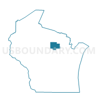
Outline

Summary
| Unique Area Identifier | 694588 |
| Name | AINSWORTH - T 1 Voting District |
| County | Langlade County |
| State | Wisconsin |
| Area (square miles) | 71.94 |
| Land Area (square miles) | 69.14 |
| Water Area (square miles) | 2.80 |
| % of Land Area | 96.11 |
| % of Water Area | 3.89 |
| Latitude of the Internal Point | 45.38057320 |
| Longtitude of the Internal Point | -88.98287850 |
Maps


Graphs
Select a template below for downloading or customizing gragh for AINSWORTH - T 1 Voting District, Langlade County, Wisconsin


Neighbors
Neighoring Voting District (by Name) Neighboring Voting District on the Map
- ELCHO - T 2 Voting District, Langlade County, WI
- ELCHO - T 3 Voting District, Langlade County, WI
- LANGLADE - T 1 Voting District, Langlade County, WI
- LANGLADE - T 2 Voting District, Langlade County, WI
- NASHVILLE - T 2 Voting District, Forest County, WI
- NASHVILLE - T 3 Voting District, Forest County, WI
- NEVA - T 1 Voting District, Langlade County, WI
- PRICE - T 1 Voting District, Langlade County, WI
- PRICE - T 2 Voting District, Langlade County, WI
- SCHOEPKE - T 1 Voting District, Oneida County, WI
- UPHAM - T 1 Voting District, Langlade County, WI
Top 10 Neighboring County Subdivision (by Population) Neighboring County Subdivision on the Map
- Elcho town, Langlade County, WI (1,233)
- Nashville town, Forest County, WI (1,064)
- Neva town, Langlade County, WI (902)
- Upham town, Langlade County, WI (676)
- Langlade town, Langlade County, WI (473)
- Ainsworth town, Langlade County, WI (469)
- Schoepke town, Oneida County, WI (387)
- Price town, Langlade County, WI (228)
Top 10 Neighboring Place (by Population) Neighboring Place on the Map
Top 10 Neighboring Unified School District (by Population) Neighboring Unified School District on the Map
- Antigo School District, WI (17,774)
- Crandon School District, WI (5,554)
- Elcho School District, WI (3,193)
- White Lake School District, WI (1,608)
Top 10 Neighboring State Legislative District Lower Chamber (by Population) Neighboring State Legislative District Lower Chamber on the Map
- Assembly District 34, WI (53,812)
- Assembly District 35, WI (52,716)
- Assembly District 36, WI (50,804)
Top 10 Neighboring State Legislative District Upper Chamber (by Population) Neighboring State Legislative District Upper Chamber on the Map
Top 10 Neighboring 111th Congressional District (by Population) Neighboring 111th Congressional District on the Map
Top 10 Neighboring Census Tract (by Population) Neighboring Census Tract on the Map
- Census Tract 9701.02, Oneida County, WI (3,629)
- Census Tract 9601, Langlade County, WI (2,703)
- Census Tract 9504, Forest County, WI (2,630)
- Census Tract 9605, Langlade County, WI (1,880)
Top 10 Neighboring 5-Digit ZIP Code Tabulation Area (by Population) Neighboring 5-Digit ZIP Code Tabulation Area on the Map
- 54520, WI (4,141)
- 54491, WI (1,652)
- 54424, WI (1,651)
- 54428, WI (1,127)
- 54418, WI (1,080)
- 54463, WI (684)
- 54465, WI (536)
- 54462, WI (348)